ONLINE MAP SHOP Largest range of Maps, Guides, CD & DVD products -
Purchase Maps online - Australia

Wall Maps
Satellite Maps and Posters
Australia Panorama Map – this reproduction of a hand painted map is based on a combination of satellite
imagery, elevation models and aerial photos.
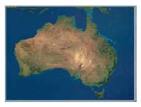
Australia from Space – satellite imagery of Australia showing continental shelves, and natural features such
as the world heritage listed Great Barrier Reef and the world’s largest monolith, Uluru (Ayers Rock).
The Living Earth, Pacific Rim View – imagery from three different satellite
systems have been used to produce this poster image.
The Living Earth - Pacific Rim View, Mural Version – as above
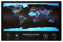
 The Brilliant Earth – This dramatic image reveals the full effect of humanity’s influence on our planet, it is a best selling gem. Produced from night time satellite images and ice data.
World Antique Map – this is an excellent reproduction antique map of the world on sturdy card stock.